Author Archives: PREDICT :: Pre-Depression Investigation of Cloud Systems in the Tropics

RF22 Into PGI46 :: Southern Caribbean

Current Conditions: The current upper tropospheric cloud-track winds and water vapor satellite imagery are presented in image 1. From west to east, we see an upper tropospheric anticyclone over the Rio Grande Valley with a nearly cutoff upper tropospheric low across the central Gulf of Mexico. A weak shortwave trough is noted across the western Great Lakes in fast upper tropospheric westerly flow. A shortwave upper tropospheric anticyclone is located over the Greater Antilles, resulting in weak diffluent flow aloft atop PGI46L near Curacao. A push of Saharan dust, per visible satellite imagery (not shown), is located to the north of PGI46L near Puerto Rico and St. Croix. A tropical upper tropospheric trough (TUTT) cell is co-located with this feature and formed as a result of strong directional shear aloft between westerly flow with the amplified subtropical ridge across the central Atlantic and easterly flow aloft to the east of PGI46L.

The highly amplified subtropical ridge referenced above is located along 30-40 W between 20-50 N. The extratropical remnants of Igor are located immediately to its west and continue to transport tropical heat and moisture to higher latitudes on the western side of this ridge. Deep layer easterlies dominate the main development region to the south of the subtropical ridge and west of Tropical Storm Lisa. As of 1200 UTC, Lisa was nearly stationary near 18 N, 30 W on the southern edge of a Saharan dust layer and surge of dry, stable mid-latitude air in the base of the trough to its north (image 2). Highly amplified upper tropospheric troughing continues across the far eastern Atlantic between 50 N, 15 W and 20 N, 30 W. Deep-layer subtropical ridging continues to the east of this feature across northern Africa. Confluent yet deformative southerly flow between the surface and 700 hPa between Lisa and this ridge from two days ago through today have progressively elongated and, as of today, dissipated the pouch associated with PGI47L near the western coast of Africa despite weak winds aloft and relatively warm SSTs.

Read entire PREDICT Weather Discussion :: 09.22.10

RF05 Video & Mission Summary

Research Flight 05  :: August 23, 2010
Mission Summary

Research flight #5 was a test/research mission into the decaying
PGI30L just north of St. Croix. A twelve dropsonde vertical
lawnmower pattern was planned, centered on the approximate wave
axis. Take off was 1000 UTC. There was no definable pouch for
PGI30L, as evident in the GFS 850 hPa co-moving streamlines
(Image 1). Dry mid-latitude air was found west of the wave axis,
with a strong inversion at ~700 hPa. There was scattered
convection east of the wave axis in a moister environment, and a
third air mass consisting of primarily dry Saharan air was
impinging on PGI30L from the east. The test of the dropsonde
system worked well, and all twelve sondes had good data. The
final drop near 1230 UTC was delayed slightly due to a GPS cable
swap, and the G-V executed a purl turn to revisit the planned
drop point. The mission was primarily conducted at 39k feet
altitude, due to a problem with the baggage compartment door
which was repaired after the mission. Since we were so close to
St. Croix, we requested an early, slow descent (2000 ft/min)
inside the NOTAM boundary from drop point #12 westward towards
drop point #1. This descent to 9000 feet provided a unique
virtual sounding across the wave axis. A sharp moisture gradient
was observed in the in situ data on the return to the exit
point, increasing from 10% to nearly 65% over a relatively short
distance (Image 2). The aircraft landed at 1400 UTC for a total
of a 4 hour mission. Though primarily a successful test mission
for the dropsonde system, some very interesting observations
were obtained in the second flight into PGI30L.

PREDICT Ensemble Discussion :: 09.16.10

PGI41L (Igor) has re-intensified into a 125-kt (Category 4)
hurricane upon completion of an eyewall replacement cycle.

PGI43L (Julia) has weakened to a 90-kt (Category 2) hurricane
due to its encounter with 20-30 kt southwesterly shear and
passage over marginal SST (26-27C).

PGI44L (Karl) has emerged westward from the Yucatan Peninsula
with its convective structure largely intact, and recent AF
Recon has found maximum winds of 55-60 kt in an intensifying
system.

PGI45L is still in the far eastern Atlantic, and is one of the
foci of this discussion.  In yesterday's forecast, there was
disagreement between NCEP and ECMWF on the location of the
pouch, and the role of the ITCZ in the development of this
system.

PGI46L is a new pouch downstream of PGI45L, at around 39W 8N. 
This potential pouch had been identified in the deterministic
and ensemble models over the past 2-3 days.

Today's 00 UTC NCEP and ECMWF ensemble products are now up on
EOL (under "Model Products").

Read more about the upcoming forecast, as well as cruise around the 
PREDICT Field Catalog and look at all of the neat products and data.

So how exactly are marsupial and hurricanes related??

Guidance From The “Marsupial Paradigm” of tropical cyclogenesis from easterly waves

“Marsupial” tracking is a real-time, experimental forecast product to track the wave “pouch” and predict the tropical cyclogenesis location using global model operational data.

The product is based on the marsupial paradigm for tropical cyclogenesis presented in a recent study by Dunkerton, Montgomery and Wang 2008 (EGU’s Atmospheric Chemistry and Physics, hereafter DMW08). The marsupial paradigm indicates that the critical layer of a tropical easterly wave is important to tropical storm formation because (see the schematic on the right)

Hypothesis 1:
Wave breaking or roll-up of the cyclonic vorticity near the critical surface in the lower troposphere provides a favored region for the aggregation of vorticity seedlings and TC formation;
Hypothesis 2:
The wave critical layer is a region of closed circulation, where air is repeatedly moistened by convection and protected from dry air intrusion;
Hypothesis 3:
The parent wave is maintained and possibly enhanced by diabatically amplified mesoscale vortices within the wave.
Read more about the Marsupial Paradigm on the Montgomery Research Group website….

How DO They Name Hurricanes?

PREDICT has been witness to several Tropical Storms and Hurricanes over the last five weeks namely Danielle, Earl, Fiona, Gaston, Hermine, Igor and Julia.  The naming convention seems obvious, alternating male and female names in alphabetical order that all have somewhat of a French/Spanish/Dutch/English flavor.  The naming convention actually changed quite a bit over the years – ranging from the name of a particular saint on which the hurricane occurred (e.g., Hurricane San Felipe in 1876), to the use of latitude/longitude positions (probably a bit too difficult for the geographically  challenged), to a rather boring phonetic alphabet approach (e.g., Able, Baker, Charlie), to women names only (“Hotlips hits Honduras” – supposedly because storms’ temperaments resemble women’s tendencies to shift directions at a whim’s notice), to the Greek Alphabet if we run out of the 21 predetermined names per year (Alpha, Beta, Gamma) and my favorite, the naming of storms after disliked politicians, used by an Australian forecaster in the early part of last century.

PREDICT Update :: Week 4

PREDICT continued its string of successful research flights during week four by conducting unprecedented multiple missions in the early stages of developing storms. Excellent guidance from the investigators on storm timing and flight track placement produced ideal sampling locations for Earth Observing Laboratory (EOL) dropsondes, which have performed nearly flawlessly during PREDICT.  Although there was only one occasion during which there was a need for two consecutive missions in one day, the NSF/NCAR Gulfstream V (GV) flew all but one day last week, using an additional 36.5 hours out of the 200 hours allocated and leaving approximately 90 hours remaining.  This period of intensive operations was possible in part due to the period of double crewing, which now has just a few days remaining.  As expected, the marine environment and cold temperatures have proven challenging for some of the aircraft instrumentation, requiring additional attention from the RAF technicians and mechanics, but the primary instrumentation for the project remains viable.  The NSF/NCAR GV aircraft has been extremely reliable during this project, to-date.

PREDICT forecasters watched Tropical Cyclone Hermine form in the Gulf of Mexico and make landfall in Texas, clobbering the Southern US with rain.  After repeated flights through Gaston, we happily said good-bye to this well-studied feature – although it was pointed out this morning that Gaston has crossed the Yucatan and once again has the potential to re-strengthen over the Pacific.  The potential for high winds from Gaston required an evacuation of the NSF/NCAR GV for one night to Barbados, but did not interfere with sampling plans otherwise. During the last couple of days the PREDICT Principal Investigators have been focusing on a system called PGI44, which slowly moved into the central Caribbean from South America rather than the western Atlantic.  Flight operations are somewhat challenging because of the vicinity of several islands and the fact that we do not have permission to fly in several near-by air spaces, but the investigators and the RAF pilots have been able to successfully target the storms nevertheless, albeit with somewhat abbreviated tracks.

The CDS/RAF mission coordinator display (www.eol.ucar.edu/flight_data), first introduced during the ADELE project in Florida last year, but fully implemented now for PREDICT, has been an invaluable tool.  This tool was developed to provide the onboard mission coordinator with storm hazard locations to safely navigate hazardous weather conditions. Using the onboard high speed satellite communications capability of NSF/NCAR aircraft, it was designed to overlay the flight track with near real-time IR satellite data (or radar data when available) along with other products that indicate storm severity, such as lightning network data and for PREDICT, a cloud overshooting tops product that has been recently produced and made available to the project by the University of Wisconsin.

Early in the PREDICT project, Computer Data Services/Research Aviation Facility software engineers flew on the aircraft and observed its use by the mission coordinator and the others on the aircraft, often making additions to the display during the fight and getting real-time feedback from the aircrews on what they needed. Because the two-way sat-com allows this product to be displayed and updated on the ground as well as in the air, it has been widely adopted by operations center scientists and anyone wishing to follow the progress of the flight.  Just like xchat, this tool has already turned into a “must-have” for all future aircraft operations! Congratulations to these software engineers, led by Chris Webster, for a spectacular new product that has contributed greatly to the success of this project and future field deployments.

Thanks to Alison Rockwell, we implemented several successful PREDICT outreach and education efforts last week.  Alison together with Carlye Calvin and Bob Hanson from UCAR Communications conducted numerous interviews with the PREDICT participants as well as willing locals, which will be used in a 30 minute PREDICT documentary.  On Tuesday, five students and instructors from the University of St. Croix visited the Operations Center and listened into the daily forecast. On Wednesday, Alison gave a presentation to about 35 8th Graders of the Earth Science class at Good Hope School, while the Michael Bell gave an interview to a Virgin Islands Daily News reporter.  On Friday, Alison and Brigitte went to Country Day School, where Alison spoke to almost 250 students ranging from grade 7 to 12 about the project. The number of questions, which increased exponentially when the students were rewarded with PREDICT stickers for speaking up, ranged from whether the dropsondes were biodegradable to whether hurricanes and typhoons ever crash into each other at the equator.  And on rainy Saturday afternoon, the Operations Center got a visit from a group of software and network engineers, and Mike Daniels provided an overview of the Operations Center network and displays that are being used.

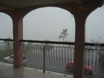
The weather has changed quite a bit in the last couple of days in St. Croix, due to the presence of PGI44, which has passed directly over us.  We have been experiencing frequent tropical rain showers for the last three days, making the heat during the day a lot more endurable however increasing the number of mosquitoes and “no see ums” as well.

Jorgen Jensen and Jose Meitin, who have both been instrumental in the planning and implementation of this project, will be leaving in a couple of days after having been here from the beginning of the project.  We owe them our thanks for the hard work and long-hours they have contributed to make PREDICT a success!

PREDICT Update – Week 2 and 3

Earlier predictions that the current hurricane season would be more active than normal seem to come through the last two weeks, when PREDICT participants closely watched the Atlantic Ocean churning out Danielle, Earl, Fiona and Gaston. An image of the line-up of all four systems can be found on the PREDICT field catalog (http://catalog.eol.ucar.edu/predict/ops/mtm_pgi_analysis/20100829/ops.MTM_PGI_Analysis.201008290700.TPW_Analysis.gif).  For more recent loops check out the University of Wisconsin website at http://cimss.ssec.wisc.edu/tropic/real-time/tpw2/natl/main.html.

Week 2 started out fairly uneventful for the PREDICT Principal Investigators (PI) as Danielle, this season’s first major hurricane, began its extratropical transition and petered out long before getting a chance to approach the US coast line.  The NSF/NCAR GV flew just one mission into a system called PGI30 on Monday, 23 August while the rest of the week was filled with a series of maintenance and hard down days.  However, the PREDICT PIs and – more importantly – the RAF folks – paid close attention to another system – PGI34 – which moved rapidly across the Atlantic and developed into Hurricane Earl.  RAF’s Evacuation Plan was put to good use on 29 August when the decision was made to relocate the aircraft to Barbados before Earl started battering several of the Caribbean Islands.  The rest of the PREDICT team stayed behind to experience heavy rains and wind gusts as Earl passed to the north of St. Croix as a Category 3 Hurricane.  Several EOL’s staff got stuck on route to St. Croix at various airports in Puerto Rico, Miami and Houston as the storm took its course.

While the GRIP and IFEX airplanes including the Global Hawk took full advantage of the intensification of Earl, and followed the storm north along the Eastern Coast Line, the PREDICT PIs turned their attention to PGI36 – Tropical Storm Fiona, flying three consecutive days out of Barbados.  A notable even happened on 30 August, when NCAR and the GV were actually mentioned in the NOAA forecasting discussions for Fiona (see below).  As a result of wind data from the dropsondes, Fiona was actually upgraded from a disturbance to a tropical storm.

TROPICAL STORM FIONA DISCUSSION NUMBER   1
NWS TPC/NATIONAL HURRICANE CENTER MIAMI FL   AL082010
500 PM EDT MON AUG 30 2010

EARLIER TODAY…ABOUT 30 DROPSONDES WERE RELEASED DURING A NSF/NCAR GV RESEARCH MISSION BEING CONDUCTED BY THE NATIONAL CENTER FOR ATMOSPHERIC RESEARCH NEAR THE AREA OF LOW PRESSURE LOCATED ABOUT 800 MILES EAST OF THE LESSER ANTILLES.  ONE OF THE DROPSONDES MEASURED A SURFACE WIND OF 35 KT APPROXIMATELY 120 N MI TO THE NORTHEAST OF THE ESTIMATED CENTER.  THIS MEASUREMENT AGREES WITH AN
ASCAT PASS FROM 1208 UTC…WHICH SHOWED A SWATH OF 30-35 KT WINDS IN THAT SAME AREA.  CONVECTION HAS BEEN A LITTLE THIN FOR MOST OF THE DAY…BUT BANDING FEATURES HAVE RECENTLY BECOME MORE PROMINENT MAINLY OVER THE WESTERN SEMICIRCLE.  GIVEN THE INCREASE IN CONVECTION AND SINCE TROPICAL STORM FORCE WINDS ARE ALREADY OCCURRING…THE SYSTEM IS BEING DIRECTLY UPGRADED TO TROPICAL STORM FIONA.

At the end of Week 3, the NSF/NCAR GV flew two more flights into PGI38 – Tropical Storm Gaston.  This system is of ongoing scientific interest and will provide additional flight opportunities during the upcoming Labor Day weekend.  It’s difficult to say where this storm will end up, especially since the Global Forecast System (GFS) and European Centre for Medium-Range Weather Forecasts (ECMWF) models seemed to have a different opinions on how its track will develop over the next few days. I am sure that some of us secretly hope for the system to head towards St. Croix for another severe weather experience.  The NSF/NCAR GV is conducted its 11th  research flights and the PREDICT PIs used about one third of their allocated flight hours, which puts them right on track with respect to resource usage.

Despite some minor issues, most of the instruments are working well.  Laura Tudor has been battling intermittent issues with the Reference GPS, getting remote help from Terry Hock and his team who are patiently waiting for another opportunity to finalize the Airborne Vertical Atmospheric Profiling System (AVAPS) installation on the Global Hawk in support of GRIP at Dryden.  The good news is that none of the data have been lost, which is significant since the dropsondes provide the most important dataset for this project.  One of the channels of the Microwave Temperature Profiler (MTP) is acting up, extending Julie Haggerty’s stay while awaiting some engineering help from Jet Propulsion Laboratory (JPL).

Tri-Agency Mission Synopsis :: 09.04.10

NSF/PREDICT:
PREDICT is planning a mission into Gaston (PGI38L) on Sunday, with a 12 UTC takeoff.  On Monday there is likely to be two missions, one with a departure of 0930 UTC and the second with a departure of 1730 UTC.  PREDICT may follow with another mission on Tuesday, if Gaston is not a Category-2 hurricane or stronger.
NOAA/IFEX:
The P-3s have completed all missions into what is now TS Earl.  The final P-3 mission was September 3, 20UTC take-off of N43RF.  This P-3 is currently ferrying back to Tampa MacDill AFB.  N42RF is at MacDill now.  The G-IV is tasked by NHC for a synoptic surveillance mission around the remnants of Gaston, which has a good chance of regenerating.  This mission is planned to be centered at 00 UTC September 7, so take-off of the G-IV would be at 1730 UTC September 6.  They will deploy to Barbados on Sunday.

NASA/GRIP:
There are no aircraft flying today (Saturday Sept. 4) for NASA, as today is a hard down day.  NASA is deploying to St. Croix for a suitcase mission into Gaston. They will deploy on Sunday for a mission on Monday, likely taking off in the afternoon or evening.  That will be followed by another mission on Tuesday, departing St. Croix and returning to Ft. Lauderdale.

There are no imminent plans for a Global Hawk mission, but there is the potential for a mission on Wednesday, possibly into the remnants of Gaston if it is in range, or in a Gulf of Mexico system if it develops.

PREDICT Ensemble Discussion :: 09.04.10

Today's weather discussion of the current and developing storms in
the Atlantic Ocean...or alphabet soup - your call.

Tropical Storm Earl is approaching Nova Scotia this morning.  Plenty
of potential genesis cases of interest.

PGI38L is ex-Gaston, which is now a tight cluster of
thunderstorms that may be getting organized.  Yesterday's European
Center for Medium-Range Weather Forecasts (ECMWF)
ensembles were more aggressive in its chances of development
than the National Centers for Environmental Prediction (NCEP)
ensembles. National Hurricane Center (NHC ) gives it 70% chance
of development over the next 48 hours.

PGI39L is an elongated area of low pressure associated with a
wave moving off Africa.  ECMWF was very aggressive with this
system, suggesting development as soon as today with high
circulation and thickness anomaly values.  NCEP presented little
chance of development. NHC gives it 20% chance of development
over the next 48 hours.

PGI40L was only initialized for the GFS, and there was no clear
evidence in the NCEP ensemble members of this system developing.

A new pouch has been declared: PGI41L over Africa, which
certainly bears watching.

NHC has identified an area of disturbed weather in the Bay of
Campeche, giving it 20% chance of development. It is likely to
remain close to land.

Read more about today's weather discussion in the PREDICT Field Catalog....

On the Job Experience :: Hurricane Research

CHRISTIANSTED, ST. CROIX (August 30, 2010) – The Boulder based National Center for Atmospheric Research’s PREDICT (Pre-Depression Investigation of Cloud Systems in the Tropics) science team is in the US Virgin Islands studying developing weather disturbances in the Atlantic. They ended up in the middle of one. They are experiencing the outskirts of hurricane Earl, a category 3 hurricane, while researching developing storms across the western Atlantic. The NCAR staff in St. Croix are fully enjoying the hurricane Earl experience, with high winds and 2-5 inches of rain expected throughout the day. Fortunately, the hotel planned ahead for hurricane season and is well prepared.

The NSF/NCAR Gulfstream V is being used to study developing weather disturbances off of the West coast of Africa moving toward the Atlantic. The PREDICT project of NCAR and NASA scientists is using the NSF/NCAR GV aircraft to understand the early formation of tropical cyclones and hurricanes. The PREDICT project is the first time that a very large-scale effort has been dedicated understanding the earliest formation of hurricanes. National Science Foundation (NSF) has funded the project, and it is expected that up to 30 flights will be made into the cloud clusters. Such a large number of flights are necessary in order to follow the development of each system over a few days, and to have sufficient number of cases for which hurricanes do and do not develop.

The NSF/NCAR Gulfstream V relocated to Barbados yesterday in order to safely continue its flight plan.  Today, it flew over the developing storm of what could potentially be the next hurricane of the season, Fiona. During the flight, over 30 dropsondes were released from the aircraft, which continuously transmit their measurements as they fall through the storm clouds. By dropping them over a large area, it is possible to measure the air motions and characteristics of the cloud clusters and the surrounding easterly wave. The NSF/NCAR GV also includes a complete instrument payload of over 25 other instruments that are specific to the PREDICT study, that collect data under flight.

As the winds stretch the palm trees sideways with each increasing gust of wind, the excitement level among the scientists heightens. To fully experience and feel the direct effects of the hurricane could be somewhat intimidating for most. However the atmospheric scientists who are here are thrilled to be in this position and makes their work really come to life. Jorgen Jensen, NSF/NCAR GV Project Manager explains, “It really puts hurricane research into perspective. As we are trying to study the formation of new hurricanes while we are actually sitting here at the hotel getting hammered by another hurricane.”

The processes determining if a cloud cluster forms or does not form a hurricane is not well understood.  However, there is immense benefit of being able to predict whether cloud cluster will lead to a hurricane. Having more advance warning of looming hurricanes would be a tremendous benefit to everyone living in hurricane affected areas.

The study began on August 15 and as today there have been 6 research flights, with about 25 more expected before the end of the study on September 30, 2010.